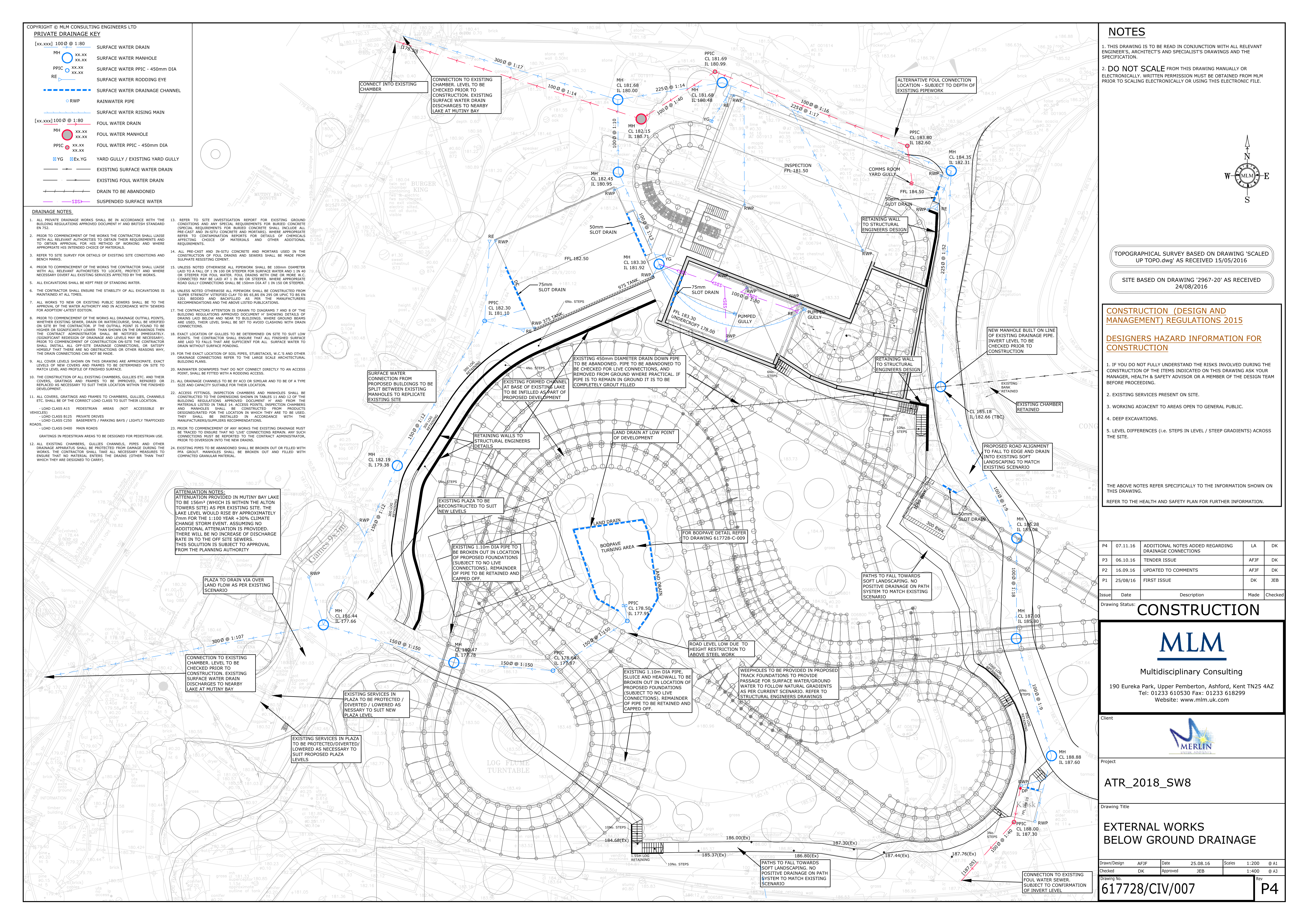
Does anyone have the map that shows the planning permission areas, it shows the general development areas not requiring the layout to be shown? (I swear I have seen it).
It will be interesting to see if the whole area from the fluke site to behind the old ripsaw site is covered.
Could this layout be either part or ride/a ruse as this area is not covered by the general development area? Whereas there are more parts of this layout that extend up behind the gloomy woods and forbidden valley.
Similar situation to the smiler and previous rides, could this layout be prone to a deviation/not be the actual layout?